
Cuchillas topographic map
Interactive map
Click on the map to display elevation.
About this map
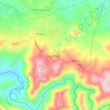
Name: Cuchillas topographic map, elevation, terrain.
Location: Cuchillas, Morovis, Puerto Rico, United States (18.28543 -66.40300 18.32438 -66.36842)
Average elevation: 948 ft
Minimum elevation: 453 ft
Maximum elevation: 1,539 ft
Other topographic maps
Click on a map to view its topography, its elevation and its terrain.
Morovis
United States > Puerto Rico > Morovis
Morovis, Puerto Rico, 00687, United States
Average elevation: 676 ft