
Löbau topographic map
Interactive map
Click on the map to display elevation.
About this map
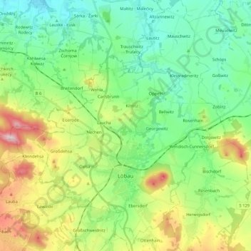
Name: Löbau topographic map, elevation, terrain.
Location: Löbau, Gœrlitz, Saxe, 02708, Allemagne (51.05544 14.59418 51.18607 14.75638)
Average elevation: 896 ft
Minimum elevation: 522 ft
Maximum elevation: 1,736 ft
Other topographic maps
Click on a map to view its topography, its elevation and its terrain.