
Teloloapan topographic map
Interactive map
Click on the map to display elevation.
About this map
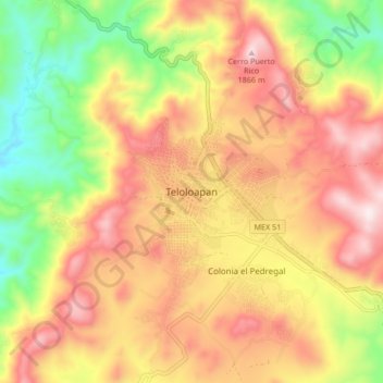
Name: Teloloapan topographic map, elevation, terrain.
Location: Teloloapan, Guerrero, México (18.32724 -99.91052 18.40724 -99.83052)
Average elevation: 5,262 ft
Minimum elevation: 4,177 ft
Maximum elevation: 6,214 ft