
Immenstedt topographic map
Interactive map
Click on the map to display elevation.
About this map
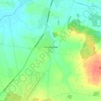
Name: Immenstedt topographic map, elevation, terrain.
Location: Immenstedt, Viöl, Nordfriesland, Schleswig-Holstein, Deutschland (54.51494 9.12977 54.56055 9.20947)
Average elevation: 56 ft
Minimum elevation: 3 ft
Maximum elevation: 154 ft