
Gebersheim topographic map
Interactive map
Click on the map to display elevation.
About this map
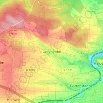
Name: Gebersheim topographic map, elevation, terrain.
Average elevation: 1,368 ft
Minimum elevation: 1,102 ft
Maximum elevation: 1,568 ft
Other topographic maps
Click on a map to view its topography, its elevation and its terrain.
Höfingen
Deutschland > Baden-Württemberg > Landkreis Böblingen > Leonberg
Höfingen, Leonberg, Landkreis Böblingen, Baden-Württemberg, 71229, Deutschland
Average elevation: 1,237 ft