Geolocate

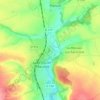
Ferrières topographic map

Click on the map to display elevation.

About this map
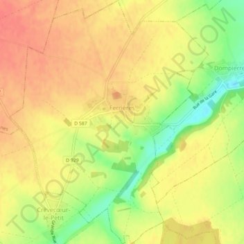
Name: Ferrières topographic map, elevation, terrain.

Location: Ferrières, Clermont, Oise, Hauts-de-France, Metropolitan France, 60420, France (49.57394 2.49536 49.60267 2.53152)

Average elevation: 377 ft

Minimum elevation: 266 ft

Maximum elevation: 436 ft

Other topographic maps

Click on a map to view its topography, its elevation and its terrain.

Blainville

France > Hauts-de-France > Oise > Ponchon

Average elevation: 315 ft

La Faïencerie

France > Hauts-de-France > Oise > Liancourt

Average elevation: 262 ft

Crécy

France > Hauts-de-France > Oise > Saint-Sulpice

Average elevation: 384 ft

Uny-Saint-Georges

France > Hauts-de-France > Oise > Rantigny

Average elevation: 226 ft

Fond Crépy

France > Hauts-de-France > Oise > Chevincourt

Average elevation: 302 ft

Chemin de l'Église

France > Hauts-de-France > Oise > Plainval

Average elevation: 374 ft

Gear up for your next adventure:

🧷Carabiner Set - Durable clips for gear attachment
💧Water Filtration Bottles - Safely drink from streams and lakes while exploring
🔋Solar Power Banks - Keep your GPS and phone charged in remote wilderness areas
🧢Outdoor Hiking Hat - Sun protection hat for outdoor explorers
🥄Camping Utensil Set - Lightweight utensils for outdoor meals

As an Amazon Associate, this site earns from qualifying purchases at no extra cost to you.