
Millbrook topographic map
Interactive map
Click on the map to display elevation.
About this map
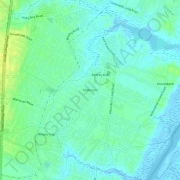
Name: Millbrook topographic map, elevation, terrain.
Average elevation: 20 ft
Minimum elevation: -10 ft
Maximum elevation: 56 ft
Routes: New Hanover County GPS tracks, routes, trails, hikes
Other topographic maps
Click on a map to view its topography, its elevation and its terrain.
Princess Place
United States > North Carolina > New Hanover County > Wilmington
Average elevation: 30 ft
Wrightsville
United States > North Carolina > New Hanover County > Wilmington > Wrightsville
Average elevation: 13 ft
Lincoln Forest
United States > North Carolina > New Hanover County > Wilmington
Average elevation: 43 ft
College Acres
United States > North Carolina > New Hanover County > Wilmington
Average elevation: 36 ft