Geolocate

Hunnan District topographic map

Click on the map to display elevation.

About this map
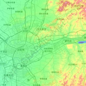
Name: Hunnan District topographic map, elevation, terrain.

Location: Hunnan District, Shenyang City, Liaoning, China (41.60251 123.36551 42.07422 123.80854)

Average elevation: 302 ft

Minimum elevation: -715 ft

Maximum elevation: 1,447 ft

Gear up for your next adventure:

🏫Relief Map Kits - Hands-on tools for teaching landforms and elevation
🪶Camping Sleeping Pad - Comfortable sleeping pad for backpacking
📶Satellite Messenger - Communication device off‑grid
🔭Stargazing Telescopes - Perfect for camping in low-light pollution areas shown on maps
🧥Men's Rain Shells - Premium waterproof and breathable jackets for mountain weather

As an Amazon Associate, this site earns from qualifying purchases at no extra cost to you.