
Farra d'Alpago topographic map
Interactive map
Click on the map to display elevation.
About this map
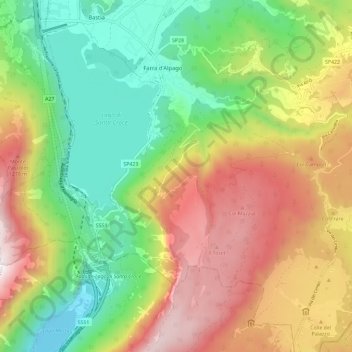
Name: Farra d'Alpago topographic map, elevation, terrain.
Location: Farra d'Alpago, Alpago, BL, Veneto, 32016, Italia (46.05860 12.30215 46.13515 12.41812)
Average elevation: 2,677 ft
Minimum elevation: 876 ft
Maximum elevation: 5,102 ft
Other topographic maps
Click on a map to view its topography, its elevation and its terrain.
Lago di Santa Croce
Lago di Santa Croce, SP423, Farra d'Alpago, Alpago, BL, Veneto, 32016, Italia
Average elevation: 1,778 ft