
Thank you for supporting this site ❤️
Make a donation
Make a donation
Gear up for your next adventure:
As an Amazon Associate, this site earns from qualifying purchases at no extra cost to you.
Timizart topographic map
Click on the map to display elevation.
Thank you for supporting this site ❤️
Make a donation
Make a donation
Gear up for your next adventure:
As an Amazon Associate, this site earns from qualifying purchases at no extra cost to you.
About this map
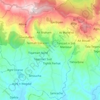
Name: Timizart topographic map, elevation, terrain.
Location: Timizart, Ouaguenoun District, Tizi Ouzou, Algeria (36.74915 4.18297 36.84603 4.29109)
Average elevation: 1,257 ft
Minimum elevation: 407 ft
Maximum elevation: 3,058 ft
Thank you for supporting this site ❤️
Make a donation
Make a donation
Gear up for your next adventure:
As an Amazon Associate, this site earns from qualifying purchases at no extra cost to you.