
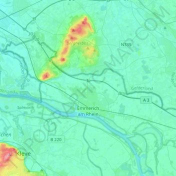
Emmerich am Rhein topographic map
Interactive map
Click on the map to display elevation.
About this map
Name: Emmerich am Rhein topographic map, elevation, terrain.
Average elevation: 59 ft
Minimum elevation: 23 ft
Maximum elevation: 328 ft
Other topographic maps
Click on a map to view its topography, its elevation and its terrain.
Elten
Allemagne > Rhénanie-du-Nord-Westphalie > Kreis Kleve > Emmerich am Rhein
Elten, Emmerich am Rhein, Kreis Kleve, Rhénanie-du-Nord-Westphalie, Allemagne
Average elevation: 69 ft
Wissel
Allemagne > Rhénanie-du-Nord-Westphalie > Kreis Kleve > Kalkar
Wissel, Kalkar, Bedburg-Hau, Kreis Kleve, Rhénanie-du-Nord-Westphalie, 47546, Allemagne
Average elevation: 56 ft