
Thank you for supporting this site ❤️
Make a donation
Make a donation
Gear up for your next adventure:
As an Amazon Associate, this site earns from qualifying purchases at no extra cost to you.
Molinos topographic map
Click on the map to display elevation.
Thank you for supporting this site ❤️
Make a donation
Make a donation
Gear up for your next adventure:
As an Amazon Associate, this site earns from qualifying purchases at no extra cost to you.
About this map
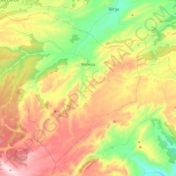
Name: Molinos topographic map, elevation, terrain.
Location: Molinos, Maestrazgo, Teruel, Aragon, Spain (40.75127 -0.55717 40.85516 -0.39695)
Average elevation: 3,205 ft
Minimum elevation: 2,064 ft
Maximum elevation: 4,541 ft
Thank you for supporting this site ❤️
Make a donation
Make a donation
Gear up for your next adventure:
As an Amazon Associate, this site earns from qualifying purchases at no extra cost to you.