Geolocate

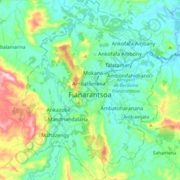
Fianarantsoa topographic map

Click on the map to display elevation.

Fianarantsoa

It is at an average altitude of 1,200 metres (3,900 ft), and has a population of 191,766.

Wikipedia (CC-BY-SA 3.0)

About this map

Name: Fianarantsoa topographic map, elevation, terrain.

Location: Fianarantsoa, District de Fianarantsoa, Haute Matsiatra, Province de Fianarantsoa, 301, Madagascar (-21.51418 47.03572 -21.39259 47.13789)

Average elevation: 3,845 ft

Minimum elevation: 3,491 ft

Maximum elevation: 4,967 ft

Gear up for your next adventure:

🧴Hand Sanitizer - Keep hands clean while hiking
🕶️GPS Smartphone Mount - Secure mount for phone navigation
☀️Outdoor Sunscreen - High protection sunscreen for outdoor activities
🌲Outdoor Survival Books - Best books on survival skills
🏕️Tent Footprint - Protect your tent base from wear

As an Amazon Associate, this site earns from qualifying purchases at no extra cost to you.