Geolocate

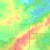
Ozark topographic map

Click on the map to display elevation.

About this map

Name: Ozark topographic map, elevation, terrain.

Location: Ozark, Johnson County, Illinois, 62967, United States (37.52194 -88.78404 37.56194 -88.74404)

Average elevation: 640 ft

Minimum elevation: 476 ft

Maximum elevation: 751 ft

Johnson County trails, hiking, mountain biking, running and outdoor activities

Other topographic maps

Click on a map to view its topography, its elevation and its terrain.
New Burnside

United States > Illinois > Johnson County

Average elevation: 584 ft

Simpson

United States > Illinois > Johnson County

Average elevation: 420 ft

Belknap

United States > Illinois > Johnson County

Average elevation: 371 ft

Cypress

United States > Illinois > Johnson County

Average elevation: 420 ft

Buncombe

United States > Illinois > Johnson County

Average elevation: 482 ft

Gear up for your next adventure:

😴Insulated Sleeping Pads - Compact and warm pads for high-elevation camping
🎒Waterproof Dry Bags - Keep your electronics and maps dry inside your pack
🏕️Family Camping Gear - Essentials for group camping trips
🥤Water Filter Bottle - All‑in‑one filter bottle for safe hydration
🦶Carbon Trekking Poles - Reduce knee impact on steep descents with ultra-light poles

As an Amazon Associate, this site earns from qualifying purchases at no extra cost to you.