
Tudanca topographic map
Interactive map
Click on the map to display elevation.
About this map
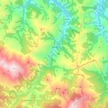
Name: Tudanca topographic map, elevation, terrain.
Location: Tudanca, Saja-Nansa, Cantabria, Cantabrie, 39555, Espagne (43.09188 -4.41271 43.21383 -4.32603)
Average elevation: 2,877 ft
Minimum elevation: 787 ft
Maximum elevation: 6,342 ft