
Thank you for supporting this site ❤️
Make a donation
Make a donation
Gear up for your next adventure:
As an Amazon Associate, this site earns from qualifying purchases at no extra cost to you.
Lhashé topographic map
Click on the map to display elevation.
Thank you for supporting this site ❤️
Make a donation
Make a donation
Gear up for your next adventure:
As an Amazon Associate, this site earns from qualifying purchases at no extra cost to you.
About this map
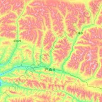
Name: Lhashé topographic map, elevation, terrain.
Location: Lhashé, Baqên County, Nagqu City, Tibet, China (31.80053 93.88609 32.19593 94.39924)
Average elevation: 15,456 ft
Minimum elevation: 12,995 ft
Maximum elevation: 18,622 ft
Thank you for supporting this site ❤️
Make a donation
Make a donation
Gear up for your next adventure:
As an Amazon Associate, this site earns from qualifying purchases at no extra cost to you.