
Mühlenberg topographic map
Interactive map
Click on the map to display elevation.
About this map
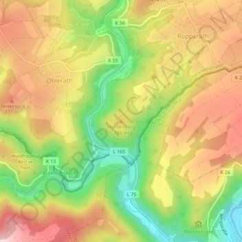
Name: Mühlenberg topographic map, elevation, terrain.
Average elevation: 1,207 ft
Minimum elevation: 774 ft
Maximum elevation: 1,588 ft
Other topographic maps
Click on a map to view its topography, its elevation and its terrain.
Bad Münstereifel
Deutschland > Nordrhein-Westfalen > Bad Münstereifel
Bad Münstereifel, Kreis Euskirchen, Regierungsbezirk Köln, Nordrhein-Westfalen, Deutschland
Average elevation: 1,148 ft
NSG Bad Muenstereifeler Wald
Deutschland > Nordrhein-Westfalen > Bad Münstereifel
NSG Bad Muenstereifeler Wald, Arloffer Straße, Kirchheim, Bad Münstereifel, Kreis Euskirchen, Regierungsbezirk Köln, Nordrhein-Westfalen, 53902, Deutschland
Average elevation: 1,371 ft