
Moselloreley topographic map
Interactive map
Click on the map to display elevation.
About this map
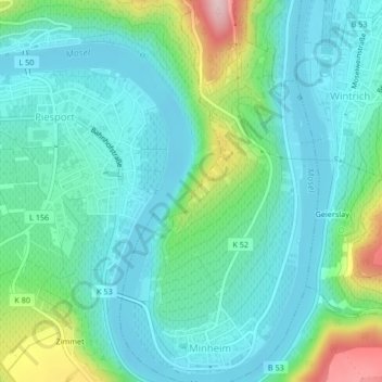
Name: Moselloreley topographic map, elevation, terrain.
Average elevation: 541 ft
Minimum elevation: 351 ft
Maximum elevation: 1,178 ft
Other topographic maps
Click on a map to view its topography, its elevation and its terrain.
Zimmet
Duitsland > Rijnland-Palts > Landkreis Bernkastel-Wittlich > Piesport
Zimmet, Piesport, Bernkastel-Kues, Landkreis Bernkastel-Wittlich, Rijnland-Palts, 54498, Duitsland
Average elevation: 607 ft
Pestkapelle
Duitsland > Rijnland-Palts > Landkreis Bernkastel-Wittlich > Piesport
Pestkapelle, Moselstraße, Niederemmel, Piesport, Bernkastel-Kues, Landkreis Bernkastel-Wittlich, Rijnland-Palts, 54498, Duitsland
Average elevation: 548 ft