
Wollaton topographic map
Interactive map
Click on the map to display elevation.
About this map
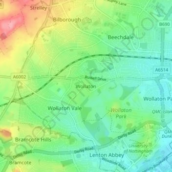
Name: Wollaton topographic map, elevation, terrain.
Location: Wollaton, Nottingham, England, NG8 2AF, United Kingdom (52.93315 -1.24043 52.97315 -1.20043)
Average elevation: 190 ft
Minimum elevation: 79 ft
Maximum elevation: 423 ft