
Île de Térénez topographic map
Interactive map
Click on the map to display elevation.
About this map
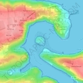
Name: Île de Térénez topographic map, elevation, terrain.
Average elevation: 128 ft
Minimum elevation: 0 ft
Maximum elevation: 381 ft
Other topographic maps
Click on a map to view its topography, its elevation and its terrain.
Le Belvédère
France > Bretagne > Rosnoën > Bellevue
Le Belvédère, D 147, Bellevue, Rosnoën, Châteaulin, Finistère, Bretagne, France métropolitaine, 29590, France
Average elevation: 236 ft
Île d'Arun
Île d'Arun, Rosnoën, Châteaulin, Finistère, Bretagne, France métropolitaine, 29590, France
Average elevation: 39 ft