
Argüedes topographic map
Interactive map
Click on the map to display elevation.
About this map
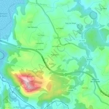
Name: Argüedes topographic map, elevation, terrain.
Location: Argüedes, Valdáliga, Cantabrië, 39593, Spanje (43.32882 -4.37610 43.36882 -4.33610)
Average elevation: 276 ft
Minimum elevation: -16 ft
Maximum elevation: 1,050 ft