
多々良沼 topographic map
Interactive map
Click on the map to display elevation.
About this map
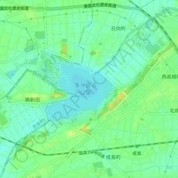
Name: 多々良沼 topographic map, elevation, terrain.
Location: 多々良沼, Tatebayashi, Ora County, Gunma Prefecture, Japan (36.25280 139.48897 36.26269 139.50130)
Average elevation: 82 ft
Minimum elevation: 56 ft
Maximum elevation: 115 ft