
Chinacates topographic map
Interactive map
Click on the map to display elevation.
About this map
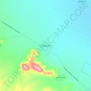
Name: Chinacates topographic map, elevation, terrain.
Location: Chinacates, Santiago Papasquiaro, Durango, México (24.97411 -105.24900 25.05411 -105.16900)
Average elevation: 6,745 ft
Minimum elevation: 6,545 ft
Maximum elevation: 7,657 ft
Other topographic maps
Click on a map to view its topography, its elevation and its terrain.
Santa Teresa del Llano
México > Durango > Santiago Papasquiaro > Santa Teresa del Llano
Santa Teresa del Llano, Santiago Papasquiaro, Durango, México
Average elevation: 7,133 ft