
山城街道 topographic map
Interactive map
Click on the map to display elevation.
About this map
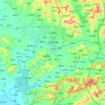
Name: 山城街道 topographic map, elevation, terrain.
Location: 山城街道, 山亭区, 枣庄市, 山东省, 中国 (34.99151 117.36745 35.14994 117.51852)
Average elevation: 702 ft
Minimum elevation: 253 ft
Maximum elevation: 2,024 ft
Other topographic maps
Click on a map to view its topography, its elevation and its terrain.