
Agafay topographic map
Interactive map
Click on the map to display elevation.
About this map
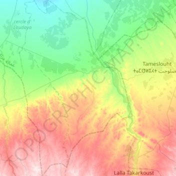
Name: Agafay topographic map, elevation, terrain.
Average elevation: 1,867 ft
Minimum elevation: 1,342 ft
Maximum elevation: 2,644 ft
Other topographic maps
Click on a map to view its topography, its elevation and its terrain.
Oulad Hassoun
Maroc > Préfecture de Marrakech
Oulad Hassoun, caïdat d’Oulad Hassoune, cercle d'Al Ouidane, Préfecture de Marrakech, Marrakech-Safi, 40062, Maroc
Average elevation: 1,657 ft