
Ghwiba topographic map
Interactive map
Click on the map to display elevation.
About this map
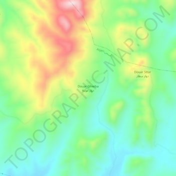
Name: Ghwiba topographic map, elevation, terrain.
Average elevation: 1,070 ft
Minimum elevation: 623 ft
Maximum elevation: 1,867 ft
Other topographic maps
Click on a map to view its topography, its elevation and its terrain.
Fejj Demna
Maroc > cercle de Moqrissat > Asjen
Fejj Demna, Asjen, Caïdat de Brikcha, cercle de Moqrissat, Province de Ouezzane, Tanger-Tétouan-Al Hoceïma, Maroc
Average elevation: 863 ft