
上水峪 topographic map
Interactive map
Click on the map to display elevation.
About this map
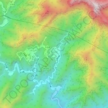
Name: 上水峪 topographic map, elevation, terrain.
Location: 上水峪, 水峪村, 房山区, 北京市, 中国 (39.85854 115.79868 39.89854 115.83868)
Average elevation: 2,188 ft
Minimum elevation: 965 ft
Maximum elevation: 4,334 ft