
Thank you for supporting this site ❤️
Make a donation
Make a donation
Gear up for your next adventure:
As an Amazon Associate, this site earns from qualifying purchases at no extra cost to you.
碱水沟 topographic map
Click on the map to display elevation.
Thank you for supporting this site ❤️
Make a donation
Make a donation
Gear up for your next adventure:
As an Amazon Associate, this site earns from qualifying purchases at no extra cost to you.
About this map
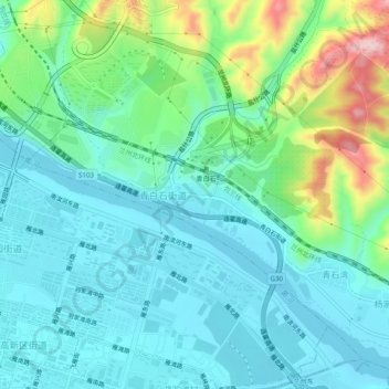
Name: 碱水沟 topographic map, elevation, terrain.
Location: 碱水沟, 青白石街道, 城关区, 甘肃省, 730020, 中国 (36.05166 103.88684 36.09166 103.92684)
Average elevation: 5,125 ft
Minimum elevation: 4,921 ft
Maximum elevation: 5,794 ft
Thank you for supporting this site ❤️
Make a donation
Make a donation
Gear up for your next adventure:
As an Amazon Associate, this site earns from qualifying purchases at no extra cost to you.