
Thank you for supporting this site ❤️
Make a donation
Make a donation
Gear up for your next adventure:
As an Amazon Associate, this site earns from qualifying purchases at no extra cost to you.
Côja topographic map
Click on the map to display elevation.
Thank you for supporting this site ❤️
Make a donation
Make a donation
Gear up for your next adventure:
As an Amazon Associate, this site earns from qualifying purchases at no extra cost to you.
About this map
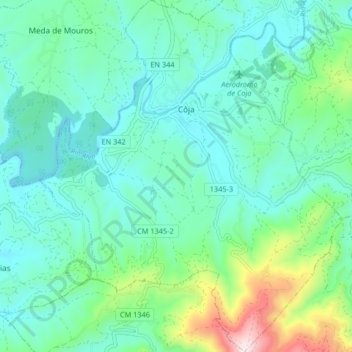
Name: Côja topographic map, elevation, terrain.
Location: Côja, Côja e Barril de Alva, Arganil, Coimbra, Portugal (40.22535 -8.02217 40.28811 -7.95138)
Average elevation: 925 ft
Minimum elevation: 509 ft
Maximum elevation: 2,493 ft
Thank you for supporting this site ❤️
Make a donation
Make a donation
Gear up for your next adventure:
As an Amazon Associate, this site earns from qualifying purchases at no extra cost to you.