Geolocate

Oberstaufen topographic map

Click on the map to display elevation.

About this map
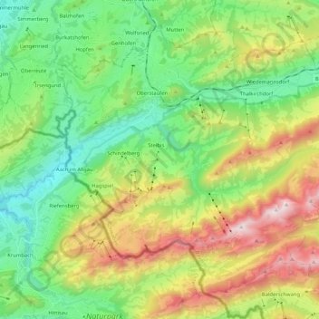
Name: Oberstaufen topographic map, elevation, terrain.

Location: Oberstaufen, Landkreis Oberallgäu, Bavaria, 87534, Germany (47.46563 9.95842 47.58342 10.16510)

Average elevation: 3,261 ft

Minimum elevation: 1,827 ft

Maximum elevation: 5,965 ft

Gear up for your next adventure:

🧭Compass with Lanyard - Easy‑carry compass for navigation
🪶Compact Camp Shovel - Folding shovel for campsite tasks
🛰️Handheld GPS Units - Professional satellite navigators for precise backcountry mapping
🦺Reflective Outdoor Gear - Safety gear for low‑light conditions
🧢Sun Protection Hats - Wide-brimmed and UPF-rated hats for high-altitude sun safety

As an Amazon Associate, this site earns from qualifying purchases at no extra cost to you.