Geolocate

Hettoli topographic map

Click on the map to display elevation.

About this map

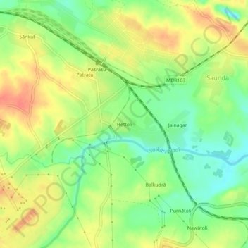
Name: Hettoli topographic map, elevation, terrain.

Location: Hettoli, Patratu, Ramgarh, Jharkhand, 829118, India (23.63701 85.29050 23.67701 85.33050)

Average elevation: 1,207 ft

Minimum elevation: 1,125 ft

Maximum elevation: 1,286 ft

Gear up for your next adventure:

🪶Fire Starter Kit - Reliable fire starter for survival and camping
🔭Stargazing Telescopes - Perfect for camping in low-light pollution areas shown on maps
👟Trail Running Shoes - Lightweight shoes for trail runners
🔦LED Headlamp - Bright and durable LED headlamp for night navigation
🧦Hiking Socks - Comfortable socks to prevent blisters on long hikes

As an Amazon Associate, this site earns from qualifying purchases at no extra cost to you.