
Sabrosa topographic map
Interactive map
Click on the map to display elevation.
About this map
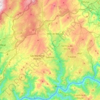
Name: Sabrosa topographic map, elevation, terrain.
Location: Sabrosa, Vila Real, Douro, North, Portugal (41.15612 -7.65817 41.41255 -7.53150)
Average elevation: 1,854 ft
Minimum elevation: 236 ft
Maximum elevation: 4,206 ft