
Baan Haad Sai Ree topographic map
Interactive map
Click on the map to display elevation.
About this map
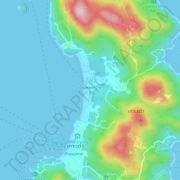
Name: Baan Haad Sai Ree topographic map, elevation, terrain.
Location: Baan Haad Sai Ree, Surat Thani Province, 84360, Thailand (10.07684 99.80919 10.11684 99.84919)
Average elevation: 256 ft
Minimum elevation: 0 ft
Maximum elevation: 1,155 ft