
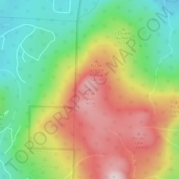
Pic de l'Ours topographic map
Interactive map
Click on the map to display elevation.
About this map
Name: Pic de l'Ours topographic map, elevation, terrain.
Location: Pic de l'Ours, Orford, Memphrémagog, Estrie, Québec, Canada (45.33709 -72.24825 45.33719 -72.24815)
Average elevation: 1,683 ft
Minimum elevation: 1,010 ft
Maximum elevation: 2,500 ft
Other topographic maps
Click on a map to view its topography, its elevation and its terrain.
Parc national du Mont-Orford
Parc national du Mont-Orford, Chemin du Parc, Orford, Memphrémagog, Estrie, Québec, J1X 0X4, Canada
Average elevation: 1,102 ft
Décharge du lac Stukely
Décharge du lac Stukely, Orford, Memphrémagog, Estrie, Québec, Canada
Average elevation: 1,053 ft