
Hann. Münden topographic map
Interactive map
Click on the map to display elevation.
About this map
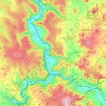
Name: Hann. Münden topographic map, elevation, terrain.
Location: Hann. Münden, Landkreis Göttingen, Lower Saxony, 34346, Germany (51.35638 9.56846 51.55769 9.80253)
Average elevation: 942 ft
Minimum elevation: 354 ft
Maximum elevation: 1,765 ft
Other topographic maps
Click on a map to view its topography, its elevation and its terrain.
Zoll
Germany > Lower Saxony > Landkreis Göttingen > Bad Lauterberg im Harz > Barbis
Average elevation: 1,033 ft