
المنصورة topographic map
Interactive map
Click on the map to display elevation.
About this map
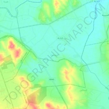
Name: المنصورة topographic map, elevation, terrain.
Location: المنصورة, معتمدية الجديدة, Manouba, Tunisia (36.74946 9.85782 36.82289 9.93652)
Average elevation: 118 ft
Minimum elevation: 56 ft
Maximum elevation: 269 ft
Other topographic maps
Click on a map to view its topography, its elevation and its terrain.