
Thavinhal topographic map
Interactive map
Click on the map to display elevation.
About this map
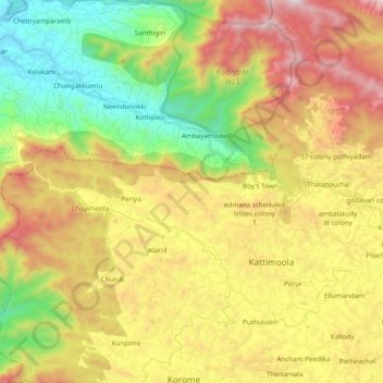
Name: Thavinhal topographic map, elevation, terrain.
Location: Thavinhal, Boy's Town, Mananthavady, Wayanad, Kerala, India (11.77066 75.79000 11.90304 75.98233)
Average elevation: 2,264 ft
Minimum elevation: 233 ft
Maximum elevation: 4,820 ft