Agua Dulce topographic map
Interactive map
Click on the map to display elevation.
About this map
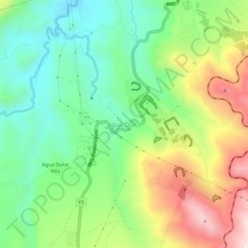
Name: Agua Dulce topographic map, elevation, terrain.
Average elevation: 12,408 ft
Minimum elevation: 11,739 ft
Maximum elevation: 13,494 ft

Click on the map to display elevation.
Name: Agua Dulce topographic map, elevation, terrain.
Average elevation: 12,408 ft
Minimum elevation: 11,739 ft
Maximum elevation: 13,494 ft