
Janefield topographic map
Interactive map
Click on the map to display elevation.
About this map
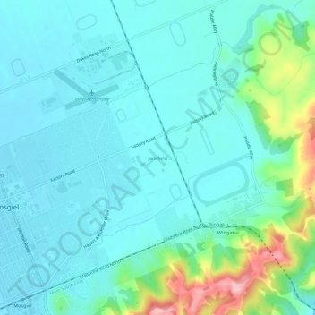
Name: Janefield topographic map, elevation, terrain.
Location: Janefield, Mosgiel, Dunedin City, Otago, 9024, New Zealand (-45.88875 170.35504 -45.84875 170.39504)
Average elevation: 154 ft
Minimum elevation: 52 ft
Maximum elevation: 577 ft