
หาดคลองเจ้า topographic map
Interactive map
Click on the map to display elevation.
About this map
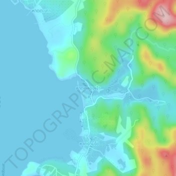
Name: หาดคลองเจ้า topographic map, elevation, terrain.
Location: หาดคลองเจ้า, จังหวัดตราด, 23120, Thaïlande (11.61564 102.52650 11.65564 102.56650)
Average elevation: 135 ft
Minimum elevation: 0 ft
Maximum elevation: 719 ft