
Ubago topographic map
Interactive map
Click on the map to display elevation.
About this map
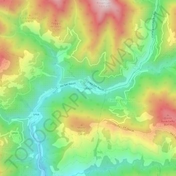
Name: Ubago topographic map, elevation, terrain.
Location: Ubago, Pigna, Imperia, Ligurie, 18037, Italie (43.91125 7.64433 43.95125 7.68433)
Average elevation: 1,614 ft
Minimum elevation: 502 ft
Maximum elevation: 3,196 ft