
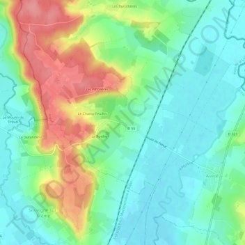
L'Aumône topographic map
Interactive map
Click on the map to display elevation.
About this map
Name: L'Aumône topographic map, elevation, terrain.
Average elevation: 384 ft
Minimum elevation: 276 ft
Maximum elevation: 591 ft
Other topographic maps
Click on a map to view its topography, its elevation and its terrain.
Les Hêtres
France > Pays de la Loire > Sarthe > Avezé
Les Hêtres, Avezé, Mamers, Sarthe, Pays de la Loire, France métropolitaine, 72400, France
Average elevation: 436 ft