
Cerdelo topographic map
Interactive map
Click on the map to display elevation.
About this map
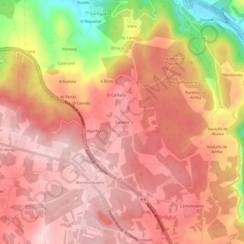
Name: Cerdelo topographic map, elevation, terrain.
Location: Cerdelo, Aranga, Betanzos, La Coruña, Galicia, 15317, España (43.20072 -8.06499 43.24072 -8.02499)
Average elevation: 1,473 ft
Minimum elevation: 856 ft
Maximum elevation: 1,739 ft