
Goueled al Lenn topographic map
Interactive map
Click on the map to display elevation.
About this map
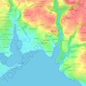
Name: Goueled al Lenn topographic map, elevation, terrain.
Average elevation: 89 ft
Minimum elevation: -3 ft
Maximum elevation: 253 ft
Other topographic maps
Click on a map to view its topography, its elevation and its terrain.
Kermoor
France > Brittany > Finistère > Port-la-Forêt
Kermoor, Port-la-Forêt, La Forêt-Fouesnant, Quimper, Finistère, Brittany, Metropolitan France, 29940, France
Average elevation: 66 ft