
Shirodi topographic map
Interactive map
Click on the map to display elevation.
About this map
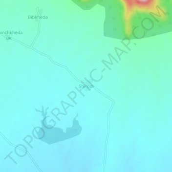
Name: Shirodi topographic map, elevation, terrain.
Location: Shirodi, Kannad, Aurangabad, Maharashtra, India (20.17676 74.97560 20.21676 75.01560)
Average elevation: 2,024 ft
Minimum elevation: 1,919 ft
Maximum elevation: 2,697 ft
Other topographic maps
Click on a map to view its topography, its elevation and its terrain.
Ambegaon Bk
India > Maharashtra > Kannad > Damani Kh
Ambegaon Bk, Damani Kh, Kannad, Chhatrapati Sambhajinagar, Maharashtra, 431147, India
Average elevation: 2,310 ft