
Paso del Cerro topographic map
Interactive map
Click on the map to display elevation.
About this map
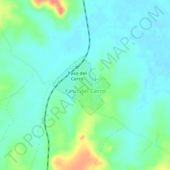
Name: Paso del Cerro topographic map, elevation, terrain.
Location: Paso del Cerro, Tacuarembó, 45000, Uruguai (-31.48292 -55.83833 -31.47335 -55.82760)
Average elevation: 459 ft
Minimum elevation: 407 ft
Maximum elevation: 614 ft
Other topographic maps
Click on a map to view its topography, its elevation and its terrain.
San Gregorio de Polanco
Uruguai > Tacuarembó > San Gregorio de Polanco
San Gregorio de Polanco, Tacuarembó, 45200, Uruguai
Average elevation: 272 ft
Paso de los Toros
Paso de los Toros, Tacuarembó, 45100, Uruguai
Average elevation: 220 ft