
黑虎岔 topographic map
Interactive map
Click on the map to display elevation.
About this map
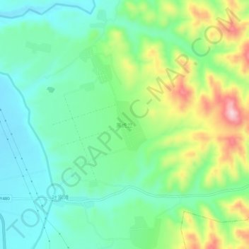
Name: 黑虎岔 topographic map, elevation, terrain.
Location: 黑虎岔, 郭城驿镇, 会宁县, 白银市, 甘肃省, 中国 (36.25314 104.89431 36.29314 104.93431)
Average elevation: 5,292 ft
Minimum elevation: 5,026 ft
Maximum elevation: 5,856 ft