
Villa Verde topographic map
Interactive map
Click on the map to display elevation.
About this map
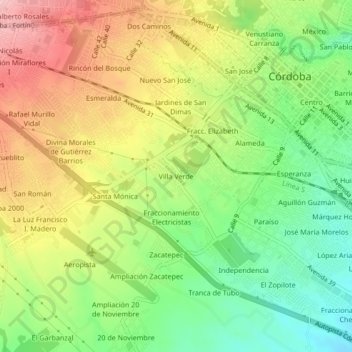
Name: Villa Verde topographic map, elevation, terrain.
Location: Villa Verde, Córdoba, Veracruz, 94570, México (18.86309 -96.96898 18.90309 -96.92898)
Average elevation: 2,867 ft
Minimum elevation: 2,585 ft
Maximum elevation: 3,199 ft
Other topographic maps
Click on a map to view its topography, its elevation and its terrain.
Los Carriles
México > Veracruz > Córdoba > Córdoba > Los Carriles
Los Carriles, Córdoba, Veracruz, 94500, México
Average elevation: 2,917 ft