
Ebbefeld topographic map
Interactive map
Click on the map to display elevation.
About this map
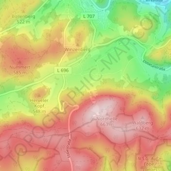
Name: Ebbefeld topographic map, elevation, terrain.
Average elevation: 1,706 ft
Minimum elevation: 1,115 ft
Maximum elevation: 2,178 ft
Other topographic maps
Click on a map to view its topography, its elevation and its terrain.
Kiesbert
Deutschland > Nordrhein-Westfalen > Märkischer Kreis > Herscheid > Kiesbert
Kiesbert, Herscheid, Märkischer Kreis, Nordrhein-Westfalen, 58849, Deutschland
Average elevation: 1,601 ft
Gasmert
Deutschland > Nordrhein-Westfalen > Märkischer Kreis > Herscheid > Gasmert
Gasmert, Herscheid, Märkischer Kreis, Nordrhein-Westfalen, Deutschland
Average elevation: 1,421 ft