
South Harriman topographic map
Interactive map
Click on the map to display elevation.
About this map
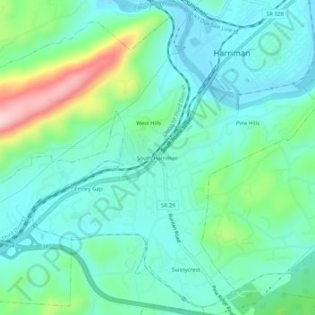
Name: South Harriman topographic map, elevation, terrain.
Average elevation: 955 ft
Minimum elevation: 735 ft
Maximum elevation: 1,667 ft
Other topographic maps
Click on a map to view its topography, its elevation and its terrain.
Pine Hills
United States > Tennessee > Roane County > Harriman
Pine Hills, Harriman, Roane County, East Tennessee, Tennessee, 37748, United States
Average elevation: 912 ft
Bazel Town
United States > Tennessee > Roane County > Harriman > Bazel Town
Bazel Town, Harriman, Roane County, Tennessee, 37748, United States
Average elevation: 1,060 ft